Friends of the Delaware Canal
145 South Main Street
New Hope, PA 18938
Phone: 215.862.2021
Michael Ginder, Executive Director
On September 9, 2022, the Friends of the Delaware Canal received the Trail of the Year Award from the Department of Conservation and Natural Resources. The timing for this recognition is perfect. It coincides with the Friends’ 40th anniversary.
“We are excited to accept this award for the Delaware Canal Towpath,” said Michael Ginder, Executive Director of the Friends. “We received a great deal of support and input from community members advocating for this nomination. Their enthusiasm for the Delaware Canal towpath earned our beloved greenway this mark of distinction.”
Pennsylvania has long been a leader in trail development and natural resource conservation. In comparison to other U.S. states, the commonwealth ranks 33rd in terms of land mass but 8th in
terms of state parks. We have over 11,000 miles of trails throughout Pennsylvania to enjoy and explore.
This award comes to us from the Pennsylvania Trails Advisory Committee. Their goal is to build enthusiasm and support for both large and small trails and raise public awareness about the value of Pennsylvania’s trail network. During the recent ceremony, representatives from the State, Park Service, and FODC met at the Locktender’s House in New Hope to officially recognize the Delaware Canal and Towpath.
Even though the Friends are the “official” recipient of the award, the Delaware Canal State Park managers and employees deserve recognition for all they do throughout the year. Preserving and protecting the Canal and towpath is truly a team effort.
*************************************************************************************************************************************
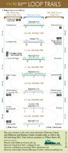
Many towpath visitors take advantage of the Loop Trails that connect Pennsylvania with New Jersey. Both states have similar canals and histories but serve very different purposes today.
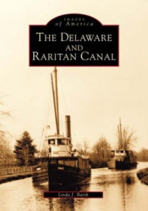
The Delaware Canal in Pennsylvania and the Delaware and Raritan Canal in New Jersey began as transportation waterways. These canals were designed mainly to transport coal to cities in both states. The Delaware and Raritan Canal crossed New Jersey from Bordentown to New Brunswick, connecting the Delaware and Raritan Rivers. The canal eliminated the need to use the Atlantic Ocean route to get from Philadelphia to New York, thus reducing travel time from two weeks to two days.
The canal boats on the Delaware Canal made their way from Easton to Bristol via New Hope. Here, boats headed to New York crossed the Delaware River via a cable ferry across the river to Lambertville. The boats continued their journey south from Lambertville on the D&R Canal. There are remnants of the cabling system in New Hope today, behind the River House at Odette’s.
This section of the D&R Canal along the Delaware River is called the feeder canal because it feeds Delaware River water into the main canal at Trenton. The feeder starts at Bulls Island and runs through Stockton, Lambertville, Washington Crossing, and Trenton.
 However, the Delaware Canal and the D&R Canal would be forever changed by the expansion of the railroad throughout the two states. In 1871, the Pennsylvania Railroad leased the D&R Canal for 999 years and, after many years of financial losses, ceased operating the canal in 1933. The remainder of the canal was turned over to the state of New Jersey in 1937.
Once the railroad began connecting major cities along the East Coast, the canal could not compete. Consider that the trains ran all night and all year, but the canals did not operate at night or during the winter. Thus, the canals went into deficit and eventually ended operation as transportation systems. Both canals became the property of their respective states.
In Pennsylvania, the canal and towpath were repurposed as the Delaware Canal State Park, which was created in 1940. In 1937, the Delaware and Raritan Canal was turned over to the state of New Jersey. And while both canals became popular recreation spots, the feeder canal of the Delaware and Raritan Canal continued its original purpose, to “feed” or send water to the main canal. This canal is operated by the New Jersey Water Supply Authority, providing drinking water to over 1,000,000 residents of Central New Jersey. As a consequence, this canal is always fully watered.
************************************************************************************************************************************
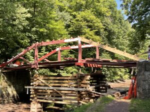
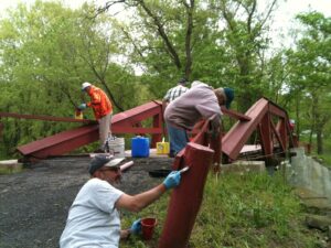
The Canal has many tales to tell, and so do the bridges and buildings along the way. The Sommer’s Bridge is no exception. In its day, farmers, quarrymen, and the townspeople used this bridge. Today, it is used solely as a pedestrian walkway. And due to its location, it gets a great deal of foot traffic.
 Sommer’s Bridge is one of the six remaining authentic camelback bridges along the towpath. These structures can be found as far south as Yardley, and as far north as Raubsville. They were built with several functions in mind. First, the design, also known as a Queenspost style bridge, had an arched design that better accommodated the crew on the canal boats. They also connected two land parcels separated by the Canal’s installation.
When they were first constructed, the camelback bridges were wooden structures with iron fasteners that added to the bridge’s stability. Workers placed these spans on stone abutments with wing walls that held the bridge about eight feet over the Canal.
The stone also has historical significance. Local materials were used to create these structures, so each one is unique depending on the camelback bridge’s location. High-quality brownstone from nearby quarries was the stone of choice in Yardley and Taylorville. Ashlar, from Lumberville, was transported north to Durham and used to build many stone abutments in that region.
The Friends have, with the help of donors and supporting organizations, restored all but one of the remaining bridges. Several camelbacks, like Sommer’s Bridge, have been restored or repaired more than once. Wooden structures are prone to decay and rot, even when maintained. So, we were not surprised that the Sommer’s Bridge experienced some structural issues this past winter that necessitated its closing. In May restoration began. It took a bit longer than originally planned as additional repairs were uncovered during the first phase of the work.
Most of the initial funding was donated by the Sommer Family. The family has a long history with the Canal and the towpath. Dr. George Sommer and his wife Anna purchased the property adjacent to the Bridge over seventy years ago. The Sommer Family have been active members of the Friends and supporters of preserving and restoring the canal structures and towpath. As is the custom with all camelback bridges, this bridge was named for the family that owned the property.
We recently received this reminiscence from the Sommer Family that we wanted to share:
“From 1951 through 2022, four generations of the Sommer family have enjoyed their property stretching from the Canal to the river. The Bridge has a very special meaning. During the 20th century flood in August of 1955, the Delaware, fed by torrential rains upriver, rose quickly on a bright summer’s day. Some family members at home were about to be trapped by the rising waters. The two youngest Sommer sisters, Anna aged six and Julie age 4, were assisted by a neighbor navigating the water on a path leading toward the Bridge and high ground. Many other area residents had the Bridge to thank for their means to safety. The Sommer Family is delighted to help the Friends of the Delaware Canal in the excellent rehabilitation of the Bridge. We do this in memory of our late family members, including Juliet C. Sommer, who died in September of 2020.”
Over the past six months, we have received contributions from other generous donors. However, additional funding will be needed to finance the completed project fully. If you would like to contribute to this bridge restoration fund, please visit our website or email us at friends@fodc.org.
************************************************************************************************************************************
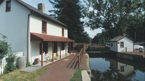
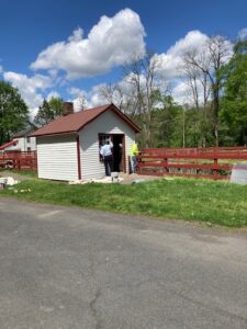
Stop by the Locktender’s House at 145 South Main Street in New Hope for a new exhibit and surprises.
 NEW EXHIBIT—Coming soon! Rediscovering the Towpath: The Legacy of William Francis Taylor. Learn about the fascinating life of William Taylor, artist, writer and early advocate for the Delaware Canal. Before the Friends of the Delaware Canal came into being, there was the Delaware Valley Protective Association, and William Francis Taylor was its first president.
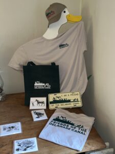
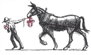
POP-UP HOLIDAY SHOP: Stop by our Pop-up Holiday Shop and find just the perfect gift that keeps on giving. Proceeds of all sales benefit the Friends. And the tastefully branded items are a great reminder of the Canal and the efforts of so many to preserve this historic landmark for generations to come. Choose from wearables and other handy items that show you care.
Please put the Locktender’s House on your holiday itinerary.We hope to see you soon!
************************************************************************************************************************************
This summer season we focused on upkeep and maintenance. The maintenance staff and laborers were busy cleaning the canal bank and towpath. Our management team responded to input from the local community, removing trees and large debris as needed. As we move into the fall, we look forward to securing contracts to execute some significant repairs and finalize design plans for others.
Staffing: As with many companies and organizations, staffing has been an issue. We were able to fill two seasonal laborer positions recently. Our hope is they will return next year.
Project updates:
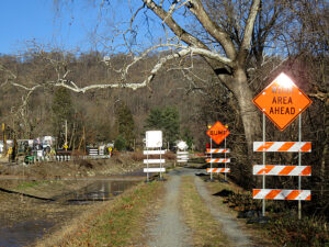
• In the northern section of the towpath and canal, temporary trail repairs in Easton have been completed. The Nockamixon Cliffs river wall and the Tohickon Aqueduct repairs are done.
• In the southern section, Sommer’s Bridge repairs are complete. The Morrisville Bridge Street Crossing is moving forward in cooperation with the Borough and PennDOT. We completed dredging at the New Hope inlet to increase the volume of water flowing south.
• Projects in the planning or bidding phase include repairs to the Lumberville Aqueduct and High Falls culvert, along with rebuilding Spahr’s Bridge in Upper Black Eddy.
Equipment: We expect our new mowers and the backhoe to arrive this fall.
Mowing: The flail mower is moving through Point Pleasant and, barring any issues, will be wrapping up its second pass of the season in the next few weeks. The boom mower is making its way South through Upper Black Eddy. The maintenance staff in the southern section of the canal has managed vegetation growth. In many places, the drought has suppressed the growth of plants along the towpath.
Water: There is currently a maintenance level of water moving as far south as possible before High Falls. Waste gates are closed to retain rainwater South of High falls. As we enter into storm season, that is subject to change to prevent exacerbating erosion at High Falls and Lumberville in cases of large rain volumes. Waste gates will be opened for storms even though everything will discharge at High Falls. Opening the gates is an effort to prevent extra water and erosion compounding our existing storm damage. We can close them post-storm to retain some water coming down off the hills and creeks.
The drought this past summer caused a drop in water levels in places that are generally fully watered. Plans are underway to help supplement the water supply in the south, while other northern projects focus on needed infrastructure repairs. We continue to work to keep the public safe and the towpath clear, improving the recreational experience for all.
Thank you all for your continued support.
See you on the towpath!
************************************************************************************************************************************
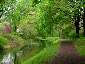
Whether you are a painter or photographer, no matter the medium, the canal inspires artists, and it has done so for nearly two centuries. As long as the canal has flowed through this region, artists have interpreted the natural beauty of this scenic waterway.
The completion of the Delaware Canal in 1832 fueled growth along its path. Mills of all kinds began to flourish along with quarries, farms, and foundries. Activity peaked during the Civil War, however many people drawn here by industry came to cherish the beauty of the local area.
By the turn of the century, New Hope and other river towns began to grow a colony of artists. These new settlers included William Lathrop, and Edward Redfield, who were joined later by Daniel Garber, Fern Coppedge, and William Taylor. They all tended to be impressionistic in style, with later artists becoming bolder in their use of color and form. Here is a brief synopsis of some of the body of work left behind for all to enjoy today.
William Langston Lathrop (1859-1938) is considered the founder of the New Hope Art Colony. He came to the hamlet of Phillips Mill in 1899 and established an art school, often taking his students on his canal boat, Sunshine, for en plein air landscaping painting excursions. Lathrop mentored many aspiring painters and was credited with attracting many artists to the area, including Daniel Garber and Morgan Colt, both members of what became known as the New Hope Group.
Along with his love of teaching, Lathrop was an avid sailor. He hand-built a sailboat named The Widge in his backyard along the Canal. It launched in 1930, and Lathrop spent a considerable amount of time sailing up and down the east coast. At the age of 79, he was sailing off the coast of Long Island when a hurricane approached. Although he sheltered in a nearby bay, he didn’t survive the storm. The Widge was found intact, however Lathrop’s body wasn’t recovered until a month later.
Edward Redfield (1869-1965) was one of the most notable American Impressionists of his time. He studied at the Pennsylvania Academy of the Fine Arts, spent time in France, met his wife, and returned to Bucks County to settle in New Hope. Redfield is often considered the “co-founder” of the New Hope Art Colony and one of the preeminent Pennsylvania Impressionists.
While many other artists were looking to European painters for inspiration, Redfield and many of his contemporaries created a new, distinctly American style. One critic Nilsen Lurvik noted that Redfield’s style of American Landscape Painting had a “veracity and force that is astonishing the eyes of the Old World.”
Fern Coppedge (1883-1951) At a very early age, Fern Coppedge displayed an exuberant use of color in landscapes often seen as drab and dull. Born in the mid-west, Coppedge studied at the Art Institute of Chicago, the Art Students League of New York with William Merritt Chase, and with Daniel Garber at the Pennsylvania Academy of the Fine Arts.
Coppedge and her husband settled in Lumberville, Bucks County in 1920, and later built a home on the river in New Hope. She was known to brave the elements, preferring plein air painting to studio work. On cold and windy days, Coppedge could be seen painting on a canvas lashed to a tree to keep it from blowing away. She is well-known for her winter snowscapes and vibrant river scenes.
Women in art had difficulty getting their work shown in galleries and exhibitions, so in response, Coppedge and a group of other female artists founded a group called “The Philadelphia Ten.” This group, which had up to 30 members at one time, shunned social norms by working and exhibiting together.
Today, Coppedge is considered a member of the Pennsylvania Impressionist School. She created approximately 1200 paintings during her lifetime; many are now housed in museums and private collections. She died in New Hope in 1951 at the age of 67.
ARTISTIC INSPIRATION TODAY
Bucks County continues to inspire many talented people. Painters, photographers, and sculptors all make their homes in our region. We are grateful to these artists, who often share their talents with us. And while we can’t make a note of them all, we took some time to speak with two working artists and Friends members, who love the canal and the artistic inspiration it provides.
Sue Ann Rainey
As Sue Ann will tell you, “I have to create every day.” This multi-faceted artist trained at The Tyler School of Art and Architecture in Graphic Arts and Photography.
During her career, Sue Ann worked as a graphic artist in publishing, owned a graphic design business, and taught evening school while raising her family. Then she decided to go back to school to become a pastry chef. She continued to paint while working as a pastry Chef for some well-known restaurants in the area.
Sue Ann is not a studio artist preferring the spontaneity of working directly from nature. When asked about her inspiration she says, “I’m drawn to the water. The canal and towpath have their own unique charms. The light filters through the trees and reflects on the water. There are so many different greens with blue sky peeking through the branches. For a person who paints outdoors, shade is also an important factor.”
Sue Ann wants to capture the river valley features and farmsteads that may not be here forever. Cuttalossa is a favorite spot, along with Stover Mill. The meandering creeks and river scenes inspire her creativity.
The Rainey family have been lifelong residents of Bucks County. She shared a charming memory of the Canal, the towpath, and her brother. When he was 15, her brother worked for the mule barge rides. He finished his shift around 1:00 in the morning and would walk the mules up the hill on Windy Bush Road to the farm where they were stabled. In the early morning hours, her mom would pick him up to bring him home.
Today, you can find Sue Ann’s works online at The Upstairs Gallery of Bucks County at theupstairsgallery.com.
Shirley Mersky
When asked what inspires her to paint a scene, Shirley says, “As a painter of light, I am particularly drawn to the canal and the river. The sparkling water and the reflections in the water inspire me. They create beautiful shapes and colors.”
A graduate of Pennsylvania Academy of Fine Arts Shirley moved to this area nearly 40 years ago. She and her husband enjoyed the outdoors and began to hike in the area. “We’ve always been hikers and went to the canal early on.” Shirley and her husband also participated in many canal walks led by then Executive Director Susan Taylor. “I love the outdoors and the history of the canal. Just being there inspires me. The landscape is different all along the canal. I often paint in Yardley and Washington Crossing due to proximity, but I love Riegelsville and Raubsville. They are unique. The canal is different wherever you go.”
Shirley continued, “I also want to emphasize how important the preservation of the towpath and the canal is to me, and I am sure to the other artists who paint it. So much farmland has been lost. It is important that we preserve the towpath and canal in their natural state. They are priceless sources of inspiration.”
While she raised a family, Shirley continued to paint. However, for the last 20 years, she has been painting full-time. At PAFA, Shirley focused on portrait and still-life painting, but the lessons learned there translate to her current work.
Today Shirley works primarily in oil and is a plein air painter. She will also use reference photos to complete the artwork in her home studio. Shirley is a member of a plein-air painting group, but often works on her own, seeking out an ideal location and the perfect light. “There is a lot of talent in this area and a lot of camaraderie,” says Shirley, and she enjoys being a part of the Bucks County artist community. It is not surprising the beauty of our area is an inspiration to many.
You can view Shirley’s artwork at shirleymersky.com.
We know there are many talented members who use the canal and its surroundings for artistic inspiration. If you are a working artist and a member of the Friends of the Delaware Canal, please let us know. We would love to hear from you.
*****************************************************************************************************************************
Welcome to the Shameless Commerce Division of the Friends of the Delaware Canal (fans of the old PBS Car Talk show will get the reference).
For your holiday shopping pleasure, we have curated a lovely selection of tastefully branded items.
The holiday season is right around the corner and we wanted to help make your gift giving pain free. So, why not shop our line of exclusive merchandise. Throw in a membership, and we will pack it all up and send a personalized holiday card with a message of your choice.
Just give us a call or stop by our website and start shopping today!
P.S. A Pop-Up Holiday Shop will open in early December in the concession building next to the Locktender’s House. Watch for our email with more details.
Canal News – Summer 2022Since the formation of the Delaware Canal State Park (originally called Roosevelt State Park) in 1940, residents along the 58.9-mile greenway have advocated for the restoration and preservation of this vital community asset. Many canals throughout the country have been filled in and paved over. The Delaware Canal remains one of the last canals capable of being fully watered once again. Many notable people have made significant contributions to the Canal over the years. And, while we can’t mention them all, we can honor those that left a unique legacy for future generations.
“Something has to be done” indeed. This short but telling quote from the founder of the Friends of the Delaware Canal, Betty Orlemann, set the tone for the vision and purpose of this organization.
In 1977, Betty and her young family took up residence in an old farmhouse on River Road in Smithtown adjacent to the Delaware Canal. Seeing the disrepair and neglect of the Canal, bridges, and towpath, she organized volunteers to get to work, doing what they could to improve the Canal and its surroundings.
This small early band of volunteers was the start of what Betty would call the Friends of the Delaware Canal. The Friends had their first official meeting in October 1982, and by January 1983, they were incorporated. One of the first members of this newly formed non-profit was Virginia Forrest.
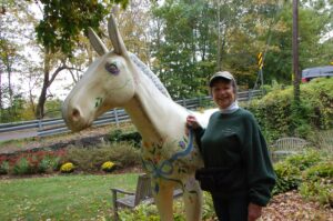
Betty was also a founder and Board member of the Delaware & Lehigh National Heritage Corridor (D & L) and the creative inspiration behind the Miles of Mules art installation. In 2009, Betty was presented with the first Lifetime Achievement Award from the D & L National Heritage Corridor.
Virginia O. Ranson Forrest was a lifelong conservationist. In the 1970s, as a member of the Delaware Valley Protective Association (DVPA), a precursor to the Friends, Virginia, along with Will Rivinus, Hal Clark, and C.P. Yoder, were instrumental in attaining the designation of National Historic Landmark for the Delaware Canal. This recognition helps preserve and protect the Canal and towpath today.
Virginia passed away in 1991; however, her legacy lives on. A popular recreation area along the Canal in New Hope bears her name, and she was the catalyst behind several other important conservation-minded groups.
Ms. Forrest founded the Bucks County Conservation Alliance and the Bucks County Audubon Society. And at the age of 83, she received the Conservation Service Award, the highest honor given to a citizen by the U.S. Department of the Interior.
Zabel Davis, Friends’ fundraiser extraordinaire, never ran from a challenge. So, when the Friends and the Park determined that the Canal needed some major excavation work, Zabel marshaled efforts to raise money for a dredging machine.
This equipment had a price tag of $100,000, a figure that would scare most from pursuing this acquisition. But undaunted, Zabel made up her mind and began raising funds by any means possible.
Through her efforts, and those of Friends members, the Pledge for the Dredge was a success. It took three years and numerous fundraising activities including cookbook sales, barge parties, and teas. Pennsylvania gratefully accepted the donation, the largest amount raised by an organization for a state project.
Susan began her relationship with the Friends as a volunteer, helping wherever she could to support their efforts. Her enthusiasm and commitment led the Friends to offer Susan the position of Executive Director of the organization, a position she held for 30 years. Now retired, Susan’s legacy continues to inspire us all.
During Susan’s tenure, much was accomplished. Camelback bridges were rebuilt, interpretive signs were installed, and the Locktender’s House was restored. Susan also created the Loop Trails, a popular way to travel and explore both sides of the Delaware River and two Canals.
“Since 1991, Susan Taylor has served as the Executive Director of the non-profit Friends of the Delaware Canal,” said Representative Brian Fitzpatrick during Susan’s retirement celebration. “For over 30 years, Susan helped preserve and protect this Canal, which helps link our community to our shared history and our area’s natural beauty…let us honor her legacy of dedicated service to this historic treasure.”

Much of the interest in the historical and ecological importance of the Delaware Canal can be attributed to the lifelong dedication of Will Rivinus. “I went on up the towpath to Easton, and I said this area is phenomenal. It has a slice of the Atlantic coast of America” said Rivinus in a recent interview. “You really need a book about the Delaware Canal. It’s fascinating.” And so, Will did just that, he wrote a book.
The Wayfarer Guide to the Delaware Canal was first published in 1964. In all, Will wrote and published eight editions of the book which included photographs from Louis Comfort Tiffany, who liked to take canal excursions on his boat, the Molly-Polly Chucker.
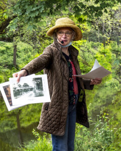
Will’s enthusiasm didn’t stop at writing about the Canal. In 1987, he led the first Canal Walk, a tradition that continues today. His tireless advocacy has been recognized by both the Senate and the House of Representatives of Pennsylvania.
No one could draw a mule like Dennis Gerhart. And he shared his love of these creatures and the Canal through his numerous illustrations, children’s books and field trip classes.
Dennis was an industrial designer by training. But it was his talent for interpreting historic structures and scenes that enhanced our understanding of the inner workings of the Canal. Dennis Scholl, an author and Education Manager at the Delaware & Lehigh Heritage Corridor said Dennis “was a unique person who not only was a master illustrator but also a man who truly understood history and could interpret it accurately, with great precision through his art. His art reflected that. He drew the best mules I have ever seen.”
Dennis may be gone from us too soon, but he left behind an archive of material that will continue to educate, inform, and amuse future generations.
When Pete Sperry participated in his first Canal Walk, sponsored annually by the Friends of the Delaware Canal, he was full of “where” questions. There were no reliable mile markers or any accurate way of knowing where you were and how far you had traveled.
So, in 2002, Pete began the challenging task of documenting and setting distances along the towpath trail. His approach was two-pronged. The mile marker situation had to be corrected, and a detailed chart of mileage and landmarks needed to be developed.
Today, his Landmarks and Mileage Chart has proven to be an invaluable resource for visitors, educators, and park staff. The information on the chart is color-coded to highlight key structures and features along the way. And it includes latitude/longitude coordinates that visitors can use to plot their course with a mapping program (like Google Maps).
You can find the Landmark and Mileage chart on our website.
Before the Friends of the Delaware Canal came into being, there was the Delaware Valley Protective Association, and William Taylor was its first president. Formed in 1933, the DVPA was responsible for encouraging the state to restore and maintain the Canal. Later, the organization was also responsible for securing an essential historic national landmark designation, protecting the Canal and towpath for generations to come.
In 1939, Taylor launched a magazine titled Towpath Magazine, a monthly publication dedicated to preserving “the beauty and value of the valley.” He wrote numerous articles focused on nature and the environment.
As an artist, William Taylor was considered part of the New Hope Impressionist School. He was well known for his landscapes and a depiction of Washington crossing
the Delaware. His works can be found at the Corcoran Gallery and the Metropolitan Museum of Art.
While many people have been a positive influence on the Canal, here are a few whose contributions made a lasting impact on the Friends as well.
Dave Heckler, a former State legislator, was instrumental in encouraging the state to buy the Locktender’s House and lease it to the Friends. The Friends, in turn, restored the house and maintain it as their headquarters and canal museum.
Robert F. Pierson was the founder of the Heritage Foundation and an early Friends supporter. He developed a database of Canal neighbors, a vital mailing list used to drive interest and membership.
C.P. Yoder, author of Delaware Canal Journal and a founding member of the Delaware Valley Protective Association. Yoder, along with Will Rivinus, Virginia Forrest and Hal Clark, lobbied for and secured the National Historic Landmark designation for the Canal and towpath.
From Bristol to Easton, residents understand the value of the Canal and towpath which connects communities with each other and with nature.
However, our Canal Tenders are at the heart of maintaining the towpath for all to enjoy. Each one has a designated section of the path they maintain, keeping it clean and visitor friendly. They often go above and beyond, removing large amounts of trash and debris and alerting the Friends and park staff of critical issues.
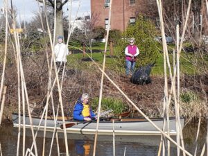
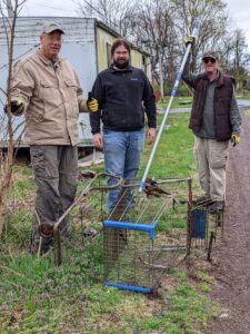
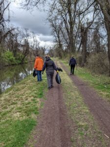
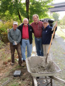
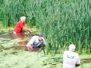
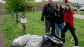
Every year, we welcome a new season with a Canal Clean-up Day. One hundred plus volunteers descend on the towpath with bags, gloves, and tools in hand to clear the way for the arrival of spring.
The Canal Tenders, seasonal volunteers, and financial supporters of the Friends all work to preserve and protect this important landmark. They carry on the legacy of so many others who came before us and set an example for future generations to follow.
Canal Clean-up day 2022 was a BIG success, and reports from our Canal Clean-up Volunteers are in…
“The morning was a lot of fun, and it was nice meeting some new people. And, we had a few walkers thank us, which really makes it all the more worthwhile! It was a very successful Canal Clean-up Day!” —Barb Dalglish
“Well that was fun! This group worked well together, and oddly, three of our four volunteers are users of the canal, but none were from our immediate area. It was a very productive morning, mild weather, everyone happy to be able to contribute.” —Charlie Bozzo.
After two years of COVID protocols, we were finally able to gather in teams to clean-up the canal and towpath. And while flooding may have postponed the clean-up in the northern sections of the towpath, in the south, it was all-hands-on-deck and paddles in the water on April 9. Most of the northern clean-ups took place during the following weeks.
Over the course of our clean-up activities, more than one hundred volunteers divided and conquered some of the most troublesome spots on the towpath. In less than 4 hours, the teams gathered 90 bags of trash (give or take) along with a shopping cart, a swimming pool, and lots of debris. Along the way, our volunteers took pictures of problem areas, hazards, and dump sites. We provided this vital input to the park staff for further investigation and resolution. When we work together, we can accomplish a great deal. And, cooperation was certainly evident during this annual clean-up. Volunteers assisted where they were needed most and got to know another section of the canal along with its neighbors.
From the comments we received, all participants were happy to participate and make a difference. So, until next year, see you on a cleaner, more welcoming towpath!
The Sommer’s Bridge Restoration, which started in May, became a more complicated project. Additional timbers were identified as needing replacement, increasing the time and materials needed to complete the job. Most of the initial required funding was donated by the Sommer’s Family, along with contributions from other generous donors. Donations and additional funding will be needed to finance the completed project.
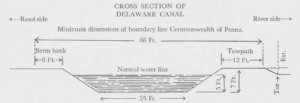
Construction of the Delaware Division of the Pennsylvania Canal system began in 1827 and was completed by 1832. The quick work created a less than water-worthy structure and the canal quickly required additional funding and manpower to keep the boats afloat.
However leaky the original design, it included many features and mechanisms that can still be seen today. In fact, some are still in use.
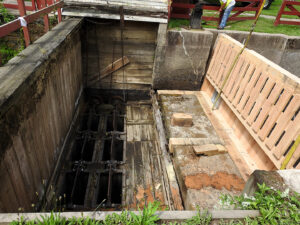
From Bristol, the Delaware Canal rises 165 feet above sea level in Easton. This elevation change was overcome using 23 lift locks. Other structures Other structures along the canal included: 10 aqueducts, 21 waste gates, 8 stop gates, 27 overflows, 125 bridges, 1 weigh lock at Easton, 1 outlet lock and 1 tide lock. With careful restoration, preservation and maintenance locks, waste gates, and bridges add to the historic value of this natural resource.
The canal structure itself is called the prism. Its name comes from the shape, being narrower on the bottom and wider on top, creating a “prism.” The bed of the canal was generally lined with clay, but in the haste of construction, other more porous materials were put to use.
Waste gates and stop gates may sound similar but they serve two different functions. Waste gates are used to lower the water level in the canal (eliminating extra or “waste” water). Stop gates are used to divert water back into the river, protecting the canal downstream from flooding. During times of torrential rains, these gates are vital to preserving not only the canal structure but neighboring property as well.
Overflows or spillways are also used to control the level of the canal. During the recent rainstorms and Ida, these spillways became so inundated with water, that pedestrians could not pass for fear of being swept away. On a normal day, bikers, hikers and walkers alike may get a bit wet but they can easily cross these concreate structures.
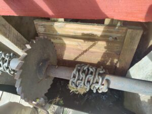
By far, the most complex mechanism along the canal is the lift lock. Locks are essentially elevators for canal boats. These enclosures were either filled with water or emptied, depending on whether the canal boat was traveling upstream (higher elevation) or downstream (lower elevation.) The lock chamber consisted of a floor, two walls and lock gates at either end. It was filled or emptied using openings in the lock gates, called wickets. (cont’d next page)
Steps to locking in when going downstream:
1. If the lock is empty, the lower miter gates are closed. The lock is then filled with water by opening the wickets (rotating valves) in the bottom section of the upper gates.
2. When the lock is full, the upper miter gates are opened, and the canal boat enters.
3. The wickets in the upper gates are shut, and the upper miter gates are fully closed.
4. The wickets in the lower gate are opened, and the level of the water in the lock is dropped until it is the same as the water level below the lock, lowering the boat.
5. When the water levels match, the lower miter gates are opened and the canal boat is pulled out of the lock and continues on its southward journey.
Lift locks have been in use for centuries in China as well as the Netherlands and Belgium. Variations of the standard lock can be found in the Theodore Roosevelt Recreation area, where two locks, Locks 22 and 23, were combined into one. At the beginning of the canal in the north, is a Weigh Lock in Easton. At the southernmost point along the canal is a Tidal Lock in Bristol.
Aqueducts are another important feature of the Delaware Canal. There are 10 aqueducts along the length of the waterway. Recent storm damage caused two of these structures to weaken or collapse entirely. Replacements and repairs are being planned for the aqueducts in Point Pleasant and Lumberville. When still in use as a transportation corridor, the aqueducts on the canal transversed streams carrying not only water but the boats as well. In later years, when commercial use stopped, these structures became a favorite watering hole of local bathers.
ith spring having sprung, and summer’s heat on the horizon, our staff and equipment have yet again taken afield to continue our annual duties of conducting maintenance and upkeep, and providing public safety and education, within our beloved park. The myriad of challenges associated in operating a park of this size and complexity continue, but we work diligently to meet our goals and fulfill our mission with continued support from the communities we serve.
Staffing: Currently the park has several seasonal maintenance vacancies and other opportunities may exist. Interested persons should contact our park office at 610-982-5560.
Aquatic Invasive Management: The park has been awarded a grant from NOAA to complete field surveys identifying target species and management areas with special consideration for habitat value, operational integrity, and recreational use of the canal.
New Equipment: Purchase orders for new mowing equipment will supplement our current operations. In the meantime, staff has begun normal seasonal mowing operations, and is working through delays due to equipment down time. We appreciate your patience and look forward to the new deliveries.
Water: In the north, staff has sent water as far south as possible, to approximately Kintnersville, before the impasse at High Falls Creek. In the south, our staff has been working diligently to keep the canal at a consistent water level. Staff and management rely on weather forecasts to gauge how much water should be flowing out of the canal at a given time, and weather patterns this spring have proven to be a challenge.
Sommer’s Bridge: Work at Sommer’s Bridge is moving forward, thanks to generous support from the Friends of the Delaware Canal! One of the few remaining authentic camelback truss bridges, a maintenance condition discovered at Sommer’s in January forced its closure.
There are many other projects that are in some phase of construction. Some are out to bid, others are awaiting final design approvals. Some projects will be completed by the park staff.
Other projects include:
• MP 53-59 Berm & Trail Flood Repairs
• Sunday Road Bridge Replacement
• Highfalls Creek Sub-Canal Culvert Replacement
• Spahr’s Authentic Camelback Truss Bridge
• Tohickon Aqueduct Repair
• Lumbersville Aqueduct over Paunacussing Creek
Thank you all for your continued support. See you on the towpath!
Canal News – Spring 2022The Friends of the Delaware Canal is a non-profit organization comprised almost entirely of volunteers. With a small staff of one full-time and one part-time employee, we can attribute nearly everything we have accomplished over the past 40 years to the many people who love the Canal and its surroundings.
Since 1982, we have accomplished many things!
While we can’t list all of the achievements of our Friends and volunteers in one article, we will attempt to highlight those contributions that have made the most significant impact. Many of these projects were funded entirely by the Friends members and supporters, most projects required sweat equity. All of these improvements have made a difference.
CAMELBACK BRIDGE RESTORATION
There are 125 bridges that span the Canal, but none are quiet as significant as the Camelback Bridges, which were designed to accommodate the Canal boats as they passed beneath the crested timber bridge. Today, six camelback bridges remain along the Canal and the Friends
have been instrumental in preserving, rebuilding, and maintaining these historic structures. We have funded the restoration
of four of these bridges and partially funded a fifth, raising over $190,000 for these projects. We have one more to go, Spahr’s Bridge, which we wrote about in our last newsletter. This reconstruction will be our largest undertaking so far.
911 BENCHES–REMEMBERING LOCAL VICTIMS
Eighteen Bucks County residents lost their lives in New York on 9/11. FODC Board members wanted to honor these victims and their families by installing teak benches along the towpath, each with a brass plaque detailing the life lost. DCNR approved the project, and the Friends
coordinated the distribution and the installation of the benches. A similar memorial bench, located in New Hope, recently took a swim downstream during the floods caused by Ida. It was recovered 30 miles away by members of the Red Dragon Canoe Club in Beverly, N.J.
INTERPRETIVE AND DIRECTIONAL SIGNS– LEARNING ABOUT THE PAST
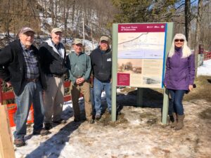
Thanks to grants from Bucks County and donations from members of the Friends, interpretive signs were purchased and installed along the towpath. These signs featured information about life on the canal, the canal boats and mules, and the history of this National landmark. Our Canal Loop trails signs maybe be the most popular and are frequently used by visitors to help them plot their course.
The Friends also developed a series of site specific signs. These signs tell the history of the towns along the river valley and their link to the Canal. These installations took place in Bristol, Levittown, Morrisville, Yardley, Washington Crossing, New Hope, Centre Bridge, Lumberville, Point
Pleasant, Smithtown, Erwinna, Uhlerstown, Upper Black Eddy, Narrowsville, and Durham. We also installed a sign in Tullytown marking a recently uncovered “Canal Boat Graveyard.”
Once the signs were developed and manufactured, our dedicated volunteers installed them with the help of the Park staff. Today, our members and supporters maintain the signs, cleaning and replacing when required.
MILE MARKERS
Forgot your Fitbit, don’t worry, we have the perfect solution, granite mile-markers.
These heavy stones are placed along the towpath in one-mile increments so you can know just how far you have gone or how far you have to go. Friends volunteers installed the stones and continue to maintain them.
CANAL TENDERS AND CLEAN-UP DAY
Visitors to the Canal and the Park grew to unprecedented numbers during the pandemic. People seeking the solace of nature hiked, biked, and paddled all along the 58.9 mile stretch of the Canal. And throughout it all, our Canal Tenders remained vigilant, clearing the towpath from debris and reporting any obstacles they encountered. These dedicated volunteers are the heart of the Friends organization. They ensure the Delaware Canal State
Park remains a pristine environment for all to enjoy.
Our Annual Canal Clean-up Day attracts volunteers from throughout Bucks County who have come to treasure the park’s natural beauty. Scout troops, high-schoolers, and retirees alike all come together on land and in water to clean up the Canal and the surrounding area.
SPRUCING THINGS UP. (PAINT, PAINT AND MORE PAINT!)
There are structures, big and small, all along the 58.9 miles of the towpath that require maintenance and repairs. Exposure to the elements, including flooding, takes a toll over time. The Friends CAT Teams tackle these projects as needed. Josh Gladwohl, one of the lead CAT Team members, often spearheads these projects, buying lumber and materials so the team is ready to get to work. These volunteers have repaired and repainted many structures including the camelback bridges, fencing and buildings. They built portable outhouse enclosures, replaced various timbers on waste gates, locks, and fencing, and maintained and replaced the interpretive signs along the way.
CLEARING THE PATH
Over the years, the Friends have been responsible for supporting the efforts of the Park staff by hiring contractors to help them tackle some urgent issues, including restoring and stabilizing the towpath bank in Washington Crossing as well as tree removal. Our Canal Tenders contribute
throughout the year, clearing debris and reporting on more serious issues when they arise.
GETTING THE RIGHT EQUIPMENT FOR THE JOB
In 1991, the Friends launched the “Pledge for the Dredge” campaign which raised $100,000 to purchase a long-arm excavator for the park. This equipment was used to clear silt from the Canal waterway, improving water flow. The Friends also raised funding for a tow truck, a rehabilitated army vehicle known as “Bomber” and some bicycles and replaced a damaged kayak. Most recently, we purchased and installed a KayaArm, a kayak launch stabilizing device on the dock at Theodore Roosevelt Recreation Area.
LOCKTENDER’S HOUSE – A FITTING HOME FOR FODC
The Friends asked the State to purchase the building in 1991 with the promise of restoring it and utilizing it as a mini historic house museum, “visitors center,” and headquarters.
On weekends in the warmer months, a docent is on hand to give visitors a tour and history of the property and the inner workings of the canal.
LET IT FLOW
Our mission statement says it best “Our primary goals are to ensure the Canal is fully-watered from Easton to Bristol and the towpath trail is usable over its entire length.” To help make this vision a reality, the Friends proposed a plan to install pumps to supplement the flow of water from the Lehigh and Delaware rivers. Today, one of these pumps is responsible for maintaining water in the canal from Centre Bridge through New Hope.
We hope to receive approvals soon to finish the installation of a pump in Washington Crossing which will augment the flow of water going south.
DO THE LOOPS
Along the way, over these 40 years, we have also had our measure of fun. We have walked, hiked, biked, laughed, lunched, skated, boated, and skied. The loop trails, which link the New Jersey and Pennsylvania Canal paths and greenways, was a concept developed and promoted by the Friends. These trails have become one of the most popular features of the Delaware River Valley in Bucks County and beyond.
40 YEARS OF STEWARDSHIP
Without our volunteers and supporters, the Friends of the Delaware Canal would not exist. Whether you donate to a project or paint a bridge, all of these contributions are a testament to the enduring and endearing qualities of the Canal and the towpath.
The Canal connects us, brings us together, and during the pandemic, it provided a much-needed respite from the anxiety we all faced. We all discovered that nature is a natural remedy with no ill side effects and it offers us a free and effortless way to restore our bodies and minds.
**************************************************************************************************
On November 16, 2021, the long-awaited Scudder Falls Shared-Use Path opened to pedestrians and bicyclists.
It was a windy Tuesday morning as guests, along with state and local officials, gathered to celebrate the completion of the new shared-use path. As workers were completing the expansion of the new toll bridge itself, the pedestrian path, which is located on the upstream side of the bridge, was formally opened.
The ceremony included a ribbon-cutting done by the descendant of the original settler, Richard Betts Scudder, along with representatives from the New Jersey and Pennsylvania Departments of Transportation and Park officials.
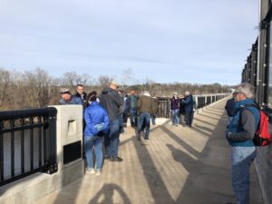
The new shared-use path improves access to the Delaware Canal towpath in Pennsylvania and the D & R Feeder Canal towpath in New Jersey, connecting Lower Makefield with Ewing, New Jersey. And it creates an additional loop trail for residents and visitors to enjoy. The 1,587-foot walkway was built to accommodate both pedestrians and cyclists with a roomy 10 feet in width and includes four scenic outlooks on the span to encourage
all to take in the scenery.
The new bridge span complex includes a 127-space park-n- ride lot located at the intersection of Taylorsville and Woodside roads in Lower Makefield and a comfort station housed in a restored stone structure that dates to 1799. Bridge and trail ramp connections can accommodate pedestrians as well as cyclists and are ADA compliant.
The span provides a traverse from Pennsylvania to New Jersey and offers some spectacular scenic views. There are four overlooks on the bridge walkway and access ramps. A new Canal pedestrian bridge and connector path located near the 1799 House improve access to this new span on the Pennsylvania side.
This project has been supported enthusiastically by many area residents and visitors alike. The size of the path is particularly appealing to bicyclists who must walk bikes across all other Delaware River Bridges. The ten-foot width of this path provides enough room for walkers, joggers and bikers to peacefully coexist.
Power-assisted bicycles along with skateboards, roller skates, rollerblades, and horses are not permitted. This project was funded by the Delaware River Joint Toll Bridge Commission.
Change is something we are used to along the Delaware Canal, and of course, it is inevitable. We are blessed to have great relationships with the Park personnel, including the out-going Park Manager, Devin Buzard. Buzard, who assumed the role in the summer of 2019, hit the ground running and made an impact along the Canal and towpath.
He began his career at DCNR’s Bureau of State Parks in 2011 and he has held several positions with increasing responsibility. Buzard will now assume a new role, overseeing the parks in western Pennsylvania. We are excited about his future and wish him continued success. His many contributions to the Canal and the park are greatly appreciated.
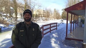
We are equally excited to work with the incoming Delaware Canal State Park Manager, Brian Heath, who has had a successful career with the park service beginning in 2011.
DCNR Secretary, Cindy Adams Dunn, gave Heath a strong endorsement. “Brian’s expert-level grasp of public relations and administrative skills continue to shine within our state parks system, as evidenced by his exemplary work at a number of our popular parks,” Dunn said. “We are thankful for his work at Gifford Pinchot and are confident Brian will rise to the challenge of managing Delaware Canal.”
“It is humbling to witness the impacts of this park on the towns, residents, and visitors along its 60-mile length, and how integral it is to daily life,” Heath said. “With an eye on the past, while looking toward the future, I am honored to continue the Department’s commitment to maintaining and improving this cherished cultural, historic, and recreational resource while preserving the natural environment for the use and enjoyment of all, for
generations to come.”
Heath is no stranger to this area. Raised in West Chester, Pennsylvania, he attended East Stroudsburg University of Pennsylvania. Heath began his career in parks at Delaware Water Gap National Recreation Area before joining DCNR in 2011 as a ranger trainee at Evansburg State Park. In 2021, Heath entered DCNR’s park manager trainee program, eventually serving as an assistant park manager at the Hickory Run State Park Complex. He previously managed Benjamin Rush Neshaminy and Gifford Pinchot State Parks.
Heath is happy to be returning to Southeastern Pennsylvania, and we are so glad to welcome him home!
The new year and change of season, evidenced by thawing ice and warming temperatures, is reflected in your beloved park, both actually and administratively. I am honored to have accepted this appointment to the park manager’s chair, and thankful for not only the welcome I’ve received, but the support and assistance provided in my inaugural weeks. Everything accomplished by our agency is through the collaborative work of a team, and nowhere is that more evident than at Delaware Canal State Park. Our maintenance, law enforcement, education and administrative personnel work diligently, under the leadership of our Assistant Managers, to continue to provide quality facilities and services for our park users. DCNR engineering staff continues to develop and accomplish large-scale repair and improvement projects to address the ongoing needs of canal infrastructure while our Regional, Central, and Director’s offices provide unending aid on high-level and technical issues impacting the park.
I have quickly learned that this park is blessed to have additional team members, beyond what the agency can provide, in The Friends of the Delaware Canal, who’s direct support I have already witnessed in my short tenure here! Again, I express my gratitude in my good fortune to join this team, and I look forward to continuing and strengthening our relationships and partnerships as we work towards our canal’s bright future.
The park has hired a new Park Ranger Trainee who will be joining the law enforcement ranks for the coming season, however, we struggle to fill a current semi-skilled laborer vacancy, while expecting several others. This entry-level maintenance position fulfills a variety of duties upkeeping
the park and is an excellent way to start a career with state parks. Interested persons should contact the park office directly for more information
at 610-982-5560.
As we anticipate the return of mowing season, funding has been allocated for new mowing equipment that we hope to have operational for the approaching season. This new equipment is expected to assist in cutting down on mowing delays caused by equipment failure.
Repairs of the 1st mile in Easton are unfortunately delayed due to loss of administrative staff in our Facility Construction and Design Bureau. While still a top priority, project dates have been pushed back.
The Menzi Muck is completing removal of a gravel bar at Milkhouse Creek in Upper Makefield, after which it will relocate to the Mt. Eyre area.
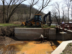
Contracted dredging has been completed, and the post-completion meeting was held in February. All locations have been dredged with the exception of an area south of Uhlerstown covered bridge. Staff hopes to complete that site as soon as possible. An estimated total of 4,000 cubic yards has been removed.
A field visit to the High Falls Creek Culvert, which was decimated by Ida, with representatives from multiple interested entities and agencies, including the Friends of the Delaware Canal, occurred in February, to provide input and assessment regarding plans for an improved replacement that pays homage to the structure’s history. Also damaged by Ida, a project scoping meeting was held at Tohickon Aqueduct in February.
Emergency removal of the Lumberville Aqueduct, another casualty of Ida, was completed. Contracted trail repairs to the area south are nearly complete, with the final seeding to be completed by the park.
PennDOT roadwork at the sub-canal culvert at Canalside Cup is expected to reach completion in the coming weeks. We are also cooperating with PennDOT to complete emergency culvert cleaning at Cuttalossa Creek near Delaware Quarries. DOT will assist us in cleaning out our portion of the culvert as well. At the time of this writing, a temporary pipe is crossing the canal and towpath to facilitate bypass pumping, and DOT will be constructing a temporary canal crossing to facilitate moving equipment to the riverside.
At Virginia Forest Recreation Area, an Electric Vehicle charging station is currently being installed as part of DCNR’s green initiative. Contractors are temporarily storing material to be used for nearby projects.
At Sommer’s Authentic Camelback Truss bridge, significant beam deterioration was noted, and upon further inspection, found to have resulted in structural deficiencies causing the structure to shift, which resulted in immediate closure for safety concerns. The park and engineering staff developed a scope of work and obtained repair estimates. The Friends of the Delaware Canal will be contributing significant financial assistance for repair, from a variety of sources including a generous private donation. This assistance will allow repairs to be completed in a much more expeditious manner.
A proposal for Spahr’s Authentic Camelback Truss bridge has been returned to the design consultant with DCNR commentary, and we await response.
A temporary road crossing at the Tebola Beans bridge outside of Washington Crossing has commenced, and as of this writing all three temporary culvert pipes have been installed and contractors are backfilling with stone. This crossing will facilitate resumed vehicle access across the canal to residents and business patrons and will provide a work platform from which contractors can demolish and replace the existing, currently closed bridge in the future.
The large-scale 12 bridge project continues to move forward in various phases of planning and design. The park awaits return of lingering temporary construction easements from various adjacent property owners in order to commence the first phase of work. With continued progress, we expect the commencement of the initial phase in the near future.
Non-compliance issues have increased in the Bristol area, including dumping and other illegal activities, putting additional strain on our law enforcement and maintenance staff, as well as our neighbors and park visitors. We ask for continued vigilance from the public by observing and reporting. Please report non-emergency information to the park office, and report emergency situations by calling 9-1-1. Your safety is our top priority, and we ask that you do not approach strangers or attempt to prevent illegal activity yourself. If you see something, say something.
The September 11 National Memorial Trail, which runs along the Towpath from Morrisville to Lumberville, has received Federal Designation and DCNR designation as a major greenway. This trail network connects all three sites from the 9/11 tragedy, as well as other nearby sites of national historic significance. Wayfinding signage is being installed in the park at access points, and a press event is expected in mid-March. More information on the trail can be found at www.911trail.org.
Members of the Friend’s Board held a productive meeting with the Regional Park office, Assistant Director, and me to discuss the Friends’ strategic planning initiative and share information. Follow-up meetings and discussions are planned.
A final thanks for the warm welcome, and ongoing support. See you on the towpath!
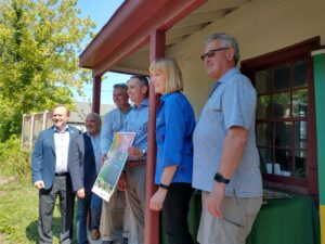
Pennsylvania’s Department of Conservation and Natural Resources (DCNR) Secretary Cindy Adams Dunn recently announced that the Delaware Canal State Park Towpath has been named Pennsylvania’s 2022 Trail of the Year. “It is my pleasure to announce that this diverse, historic trail has been selected to be Pennsylvania’s 2022 Trail of the Year,” Dunn said. “Today, we celebrate the Delaware Canal State Park Towpath and the multitude of outdoor recreation opportunities it has provided for generations, as it continues to be a destination for so many people. With this honor, I am hopeful that even more people seek out this gem of a trail and the larger region to which it connects its users.”
“The Friends of Delaware Canal, recipients of the award, are honored that the Delaware Canal State Park Towpath was named Pennsylvania’s 2022 Trail of the Year,” Michael Ginder, executive director of the Friends of Delaware Canal said. “The towpath has much to offer with a rich history and has seen an increase in visitors the past couple of years as more and more individuals spend time outdoors. The Trail of the Year recognition will allow the Friends to build on that increased visitor momentum as well as bolster the work we do to ensure the towpath trail is usable over its entire length.”
There are over 12,000 miles of trails in Pennsylvania, so this recognition is significant. It highlights the Canal towpath’s many virtues. With access to all forms of recreation from, boating to biking, this greenway provides exceptional outdoor adventures for all to enjoy. We encourage everyone to come out and experience all the Canal towpath has to offer as the 2022 Trail of the Year!
To our members and friends who contributed to the Friends year-end appeal, we say THANK YOU! Your commitment to investing in the work we do to restore, preserve and improve the Delaware Canal and its surroundings is needed more than ever.
![]() It comes at a time when the Canal and towpath once again suffered at the hands of Mother Nature. Tropical Storm Ida left behind a great deal of damage to the towpath as well as canal structures like culverts and aqueducts. And while we are confident that the state will provide funding for much of the repair and restoration work, we still need our grassroots organization to bolster their efforts.
It comes at a time when the Canal and towpath once again suffered at the hands of Mother Nature. Tropical Storm Ida left behind a great deal of damage to the towpath as well as canal structures like culverts and aqueducts. And while we are confident that the state will provide funding for much of the repair and restoration work, we still need our grassroots organization to bolster their efforts.
So, we are grateful to all who participated in the end-of-year appeal. And we look forward to celebrating our 40th Anniversary in 2022.
Friends of the Delaware Canal
145 South Main Street
New Hope, PA 18938
Phone: 215.862.2021
Michael Ginder, Executive Director
Helping on Canal Clean-up Day is just one way you can get involved and help to restore, preserve and improve the Delaware Canal. Big or small, the perfect job for you awaits – all you need to do is get involved! FIND OUT MORE